
Understanding Ethiopia’s Earthquakes and Volcanic Activity: A Geologist’s Insight
Ethiopia’s earthquakes and volcanoes are primarily due to the East African Rift Valley, which is a result of tectonic processes initiated millions of years ago. The mantle’s constant movement causes molten rock to rise, leading to rifting and seismic activities. Recent earthquakes have raised concerns about potential volcanic eruptions, prompting calls for better monitoring and community engagement.
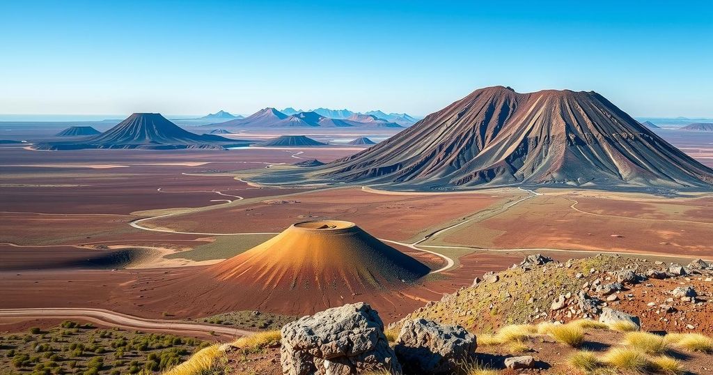
Ethiopia experiences frequent earthquakes and volcanic activity due to its position along the East African Rift Valley, a geologically dynamic area. This process began 18 million years ago with the separation of continents, leading to the formation of the Red Sea. Approximately 11 million years ago, a rift formed underneath the Afar Depression in northeast Ethiopia, which has since been filling with molten rock from the Earth’s mantle and causing tectonic movements.
The mantle, a hot semi-solid layer beneath the Earth’s crust, contributes to volcanic eruptions. Jobman, molten rock sometimes forces its way through crustal weaknesses, resulting in eruptions. Concurrently, the ground experiences rifting, wherein tectonic plates move apart, creating gaps filled with magma. This rifting causes seismic activities, manifesting as earthquakes.
The Afar region is among the globe’s most tectonically active regions. Recent seismic activities near Fentale and Dofan have resulted in over 200 earthquakes with magnitudes surpassing 4, including a notable 6 on the Richter scale. While there have been no recent volcanic eruptions, the region remains historically significant, with the last eruption at Fentale recorded in 1820.
Scientists have noted that the recent cluster of earthquakes not only damaged infrastructure but also raised concerns about potential volcanic eruptions, as seismic activity can precede such events. Satellite radar imagery has shown that these earthquakes stem from hot, molten rock pushing up from a depth of about 10 kilometers.
Three potential scenarios could unfold due to this ongoing geological activity: 1) Cooling of the molten rock, leading to solidification; 2) Eruption after the molten material breaches the surface; or 3) Lateral movement of molten rock that may influence surrounding materials, potentially resulting in cooling or an eruption. The complexities of these processes pose challenges for scientists aiming to predict outcomes and mitigate hazards.
To enhance predictive accuracy, scientists advocate for advanced monitoring techniques, such as volcanic gas measurements and GPS monitoring. Furthermore, establishing effective communication channels among scientists, government officials, and local communities at risk is critical for preparedness and response to geological hazards in the region.
Ethiopia’s geological landscape is marked by the East African Rift Valley, which drives its seismic and volcanic activities. The complexities of rifting and molten rock movements have significant implications for the local populations. Enhanced scientific monitoring and community collaboration are essential for understanding and mitigating the risks associated with these natural phenomena. As events continue to unfold, ongoing research will contribute to safer living environments for the communities affected by potential volcanic eruptions and earthquakes.
Original Source: www.downtoearth.org.in


