Tropical Disturbance in Gulf Strengthens; Depression Forecasted to Form Soon

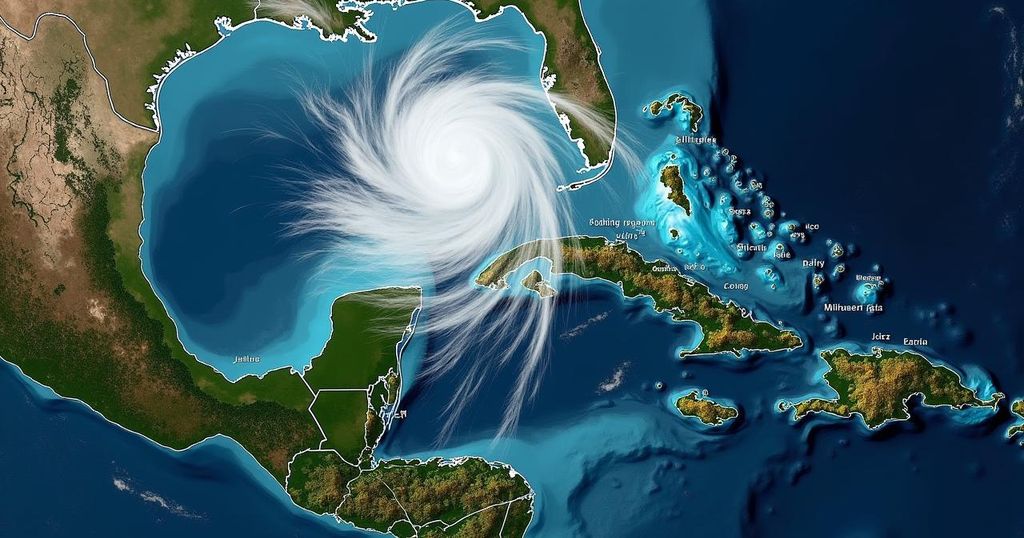
The tropical disturbance in the Gulf of Mexico is strengthening and expected to form into a depression soon, with an 80% chance of development in seven days. Florida and nearby regions may experience heavy rainfall and gusty winds beginning late this weekend, with potential flooding due to saturated ground conditions. The storm’s trajectory and strength remain uncertain, while additional tropical systems are also being monitored.
The tropical disturbance in the Gulf of Mexico is intensifying and is projected to evolve into either a tropical or subtropical depression within the next few days, as indicated by the National Hurricane Center (NHC). An update released at 2 a.m. on Saturday reports an 80% probability of development over the course of seven days and a 50% chance within the next 48 hours. Although the system presents as a broad area of low pressure, it is currently generating winds that are approaching gale force, according to the NHC. Meteorologist Rebecca Barry from Max Defender 8 predicts that a tropical storm or a Category 1 hurricane is expected to traverse the state late Tuesday night into Wednesday, potentially adopting the next name on this year’s list: Milton. The state of Florida, along with the Yucatan Peninsula of Mexico and the Bahamas, is advised to closely monitor the progress of this system as it advances eastward or northeastward in the Gulf. Barry remarked, “It is too soon to ascertain which areas will be most affected, as this heavily depends on the point of landfall.” The NHC warns of gusty winds and substantial rainfall anticipated over Florida and parts of Mexico starting late this weekend and continuing into early next week. Chief Meteorologist Jeff Berardelli from Max Defender 8 noted that heavy rainfall is expected to commence on Sunday, coinciding with the arrival of the first wave of moisture at Florida’s coast. This pattern of rainfall interspersed with dry periods is expected to persist through Tuesday. Berardelli further cautioned, “Considering that the ground is saturated after experiencing one of the rainiest wet seasons on record, any downpours could result in flooding.” Although the storm’s precise trajectory and intensity upon arrival in Florida by Wednesday remains uncertain, forecasts suggest that Central to South Florida may experience 5 to 10 inches of rainfall. Additionally, a new tropical wave has emerged off the African coast with an assessed 30% chance of development within seven days as it moves across the Atlantic. The NHC acknowledges that some development of this wave is possible. In the Open Atlantic, Hurricane Kirk maintains its formidable strength, with large swells expected to arrive on the U.S. East Coast by Sunday. Hurricane Leslie, situated in the Tropical East Atlantic, has also shown slight strengthening as it continues its west-northwestward journey.
The article discusses an intensifying tropical disturbance located in the Gulf of Mexico, which is on the verge of developing into a tropical or subtropical depression. It emphasizes the potential impacts this weather system may have on regions such as Florida, the Yucatan Peninsula of Mexico, and the Bahamas. The article provides updates from the National Hurricane Center regarding the system’s development and forecasts regarding winds, rainfall, and the possibility of flooding, particularly in Florida where the ground is already saturated from previous rainfall. Additionally, the article highlights other tropical systems forming in the Atlantic, providing a comprehensive overview of the current tropical climate.
The article articulates the strengthening of a tropical disturbance in the Gulf of Mexico, which is predicted to become a tropical or subtropical depression shortly. With a significant potential for development and adverse weather conditions affecting Florida and surrounding areas, residents are advised to prepare for the possibility of strong winds and heavy rainfall leading to flooding. Monitoring updates from meteorological authorities is recommended as the situation develops throughout the upcoming week.
Original Source: www.wfla.com


